Tile plan where each tile is centered on a user-supplied (x, y) coordinate with a uniform tile size. The center coordinates are primary — for use cases like survey sampling, object detection patches, or site-centered extractions where the point location is semantically meaningful.
Utility class for tiling centered on arbitrary (x, y) coordinates with a uniform tile size. Unlike grid-based tile plans, tile placement is driven entirely by the supplied point locations.
All coordinates, tile dims, and padding live in one consistent reference
frame set by $input ("spatial" for CRS units, "pixel" for pixel
indices). The bound type returned by getTile() is a separate concern
controlled by $output and resolved at extraction time.
Usage
pointTilePlan(
  input = c("spatial", "pixel"),
  output = input,
  coords = NULL,
  width = NULL,
  height = NULL,
  ...
)
Arguments
- input
character. Coordinate space of coords, dims, and padding:
"spatial"for CRS units,"pixel"for pixel indices.- output
character. Bound type returned by
getTile(). Defaults toinput. Cross-mode conversion requires aSpatRasteratgetTile()time (or@rast_dims/@extentset on the plan for standalone use).- coords
n x 2 matrix or data frame of tile center coordinates (columns: x, y). Data frames are coerced via
as.matrix(). Equivalent tox$coords <- valueafter construction.- width
numeric. Uniform tile width in input coordinate units. Equivalent to
x$width <- valueafter construction.- height
numeric. Uniform tile height in input coordinate units. Equivalent to
x$height <- valueafter construction.
Slots
coordsmatrix. n x 2 matrix of tile center coordinates (columns: x, y).
inputcharacter. Coordinate space of coords, dims, and padding:
"spatial"for CRS units,"pixel"for pixel indices.outputcharacter. Bound type returned by
getTile():"spatial"or"pixel". Defaults toinput. Evaluated atgetTile()time, not[i].rast_dimsnumeric.
c(nrow, ncol)of the reference raster. Required forplot()wheninput = "pixel"and for cross-mode conversion without a raster.extentnumeric.
c(xmin, xmax, ymin, ymax)of the reference raster. Required for pixel → CRS conversion without a raster.nnumeric. Number of tiles (equals number of input points).
dimsinteger. Always
c(n, 1L).tile_dimsnumeric. Uniform
c(height, width)in input coordinate units.padnumeric. Tile padding in input coordinate units.
metadatadata.frame. Per-tile metadata; always has
"tile","x", and"y"columns.
Setup
pointTilePlan()creates an instance.inputdefaults to"spatial";outputdefaults toinput.$coords<-sets the n x 2 center coordinate matrix (columns: x, y). Data frames are also accepted and coerced viaas.matrix().$width<-/$height<-set the uniform tile width and height in input coordinate units.$input<-/$output<-change the coordinate / output mode.$nrows<-/$ncols<-are aliases for$height<-/$width<-for consistency with pixelTilePlan when using pixel coordinates.$rast_dims<-setsc(nrow, ncol)of the reference raster — required forplot()wheninput = "pixel"and for cross-modegetTile()calls when no raster is provided.$extent<-setsc(xmin, xmax, ymin, ymax)— required for pixel → CRS conversion without a raster.
Coordinate modes and required raster metadata
| Scenario | @rast_dims | @extent |
input = "spatial", output = "spatial" | not needed | not needed |
input = "pixel", output = "pixel" | for plot() | not needed |
input = "pixel", output = "spatial" | required | required |
input = "spatial", output = "pixel" | required | derived |
When getTile() is called with a SpatRaster, the raster's own metadata
is used for conversion — @rast_dims and @extent are only needed for
standalone operations (plotting, validation) without a raster.
Getting tile bounds
[i] returns bounds in the input coordinate space: SpatExtent when
input = "spatial", integer[4] when input = "pixel". $output is not
consulted at [i] time. Use getTile() for output-mode conversion.
Pixel mode and center ambiguity
When input = "pixel", tile dims should be odd for an unambiguous center
pixel. With even dimensions center ± width/2 produces non-integer bounds
that are truncated by as.integer().
metadata
After setting coords, metadata is auto-populated with "tile", "x", and
"y" columns. Additional columns can be added via $<-.
See also
Other tile plans:
freeTilePlan,
freeTilePlan-class,
pixelTilePlan-class,
quadtreePlan(),
spatialTilePlan-class,
tilePlan,
tilePlan-class,
tilework-class
Other tile plans:
freeTilePlan,
freeTilePlan-class,
pixelTilePlan-class,
quadtreePlan(),
spatialTilePlan-class,
tilePlan,
tilePlan-class,
tilework-class
Examples
tp <- pointTilePlan("spatial")
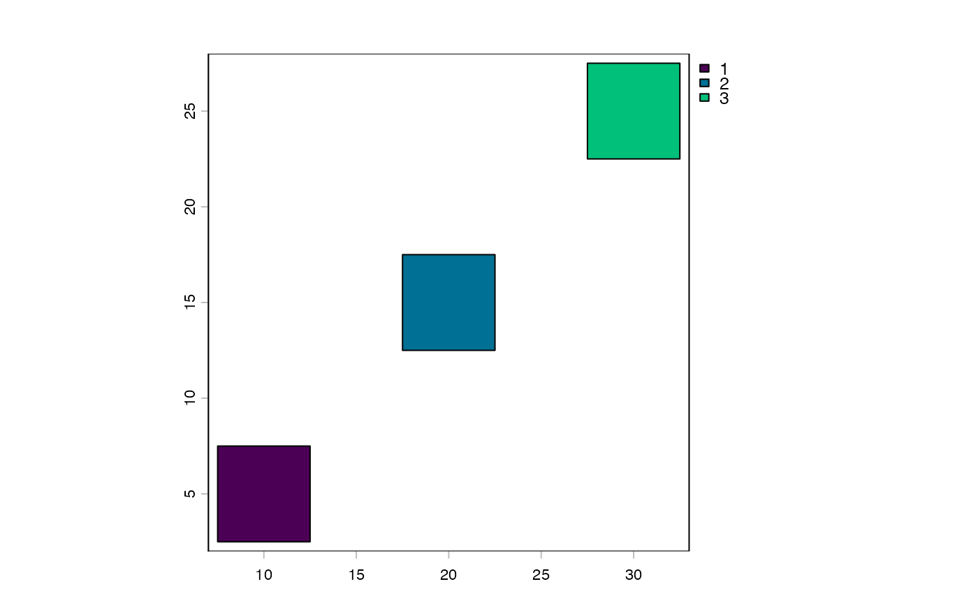
tp$coords <- cbind(x = c(10, 20, 30), y = c(5, 15, 25))
tp$width <- 5
tp$height <- 5
tp
#> Object of class pointTilePlan
#> input : spatial
#> output : spatial
#> n : 3
#> tile_dims : 5, 5 (height, width)
#> pad : 0
length(tp)
#> [1] 3
tp[1]
#> [[1]]
#> SpatExtent : 7.5, 12.5, 2.5, 7.5 (xmin, xmax, ymin, ymax)
#>
tp[2:3]
#> [[1]]
#> SpatExtent : 17.5, 22.5, 12.5, 17.5 (xmin, xmax, ymin, ymax)
#>
#> [[2]]
#> SpatExtent : 27.5, 32.5, 22.5, 27.5 (xmin, xmax, ymin, ymax)
#>
centroids(tp)
#> class : SpatVector
#> geometry : points
#> dimensions : 3, 0 (geometries, attributes)
#> extent : 10, 30, 5, 25 (xmin, xmax, ymin, ymax)
#> coord. ref. :
plot(tp)
 # CRS input, pixel output (raster needed at getTile time)
tp2 <- pointTilePlan(input = "spatial", output = "pixel")
tp2$coords <- cbind(x = c(10, 20), y = c(5, 15))
tp2$width <- 100
tp2$height <- 100
# CRS input, pixel output (raster needed at getTile time)
tp2 <- pointTilePlan(input = "spatial", output = "pixel")
tp2$coords <- cbind(x = c(10, 20), y = c(5, 15))
tp2$width <- 100
tp2$height <- 100